Trails · Madeira
Madeira Hiking Map and Trail Transport
Madeira hiking map and trail transport advice help you locate walking areas and plan access, with official sources to check before you go.
Madeira hiking map: five trailhead locations
Find the walking area first, then use the numbered key and transport table below. The pins locate official access points; they do not show trail paths, bus roads or live closures.
- 1. PR1: Pico do Areeiro
- 2. PR11: Ribeiro Frio / Balcões
- 3. PR8: Baía d’Abra / São Lourenço
- 4. PR9: Queimadas / Caldeirão Verde
- 5. PR6 / PR6.1: Rabaçal access
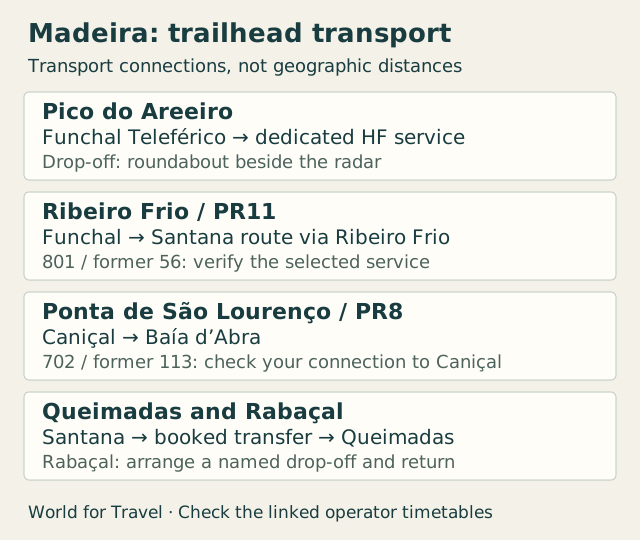
Madeira trailheads by bus: stops and return plans
Choose the walking route before choosing a bus. The table distinguishes a trailhead stop from a nearby town that still needs a transfer. SIGA lists new numbers alongside older numbers, and some departures follow different roads. Check the linked timetable for your operating day and confirm that your selected bus serves the named stop.
The HF Pico do Areeiro timetable checked on 8 October 2026 lists Funchal departures at 06:00 and 13:30, arriving at the radar roundabout at 06:45 and 14:15. Returns depart at 12:15 and 19:00 through 24 October; from 25 October 2026, the last return changes to 18:00. Recheck the operator page before travel. These times support a return to Areeiro, not collection at Pico Ruivo.
| Option | Bus or service | Get off / start | Walk finish and return |
|---|---|---|---|
| PR1: Pico do Areeiro | Bus or serviceHF dedicated Pico do Areeiro service; board at Teleférico-Término (4A), Funchal | Get off / startPico do Areeiro roundabout beside the radar; walk begins at the viewpoint area. | Walk finish and returnThe short Pedra Rija outing returns to Areeiro. Full PR1 is one-way beyond Pedra Rija; arrange onward walking and collection after Pico Ruivo. This bus does not collect you at Ruivo. |
| PR11: Vereda dos Balcões | Bus or service801 (former 56), Funchal / Santana. Select a departure via Ribeiro Frio; not every variant serves it. Compare the older named-stop timetable with the current operator schedule. | Get off / startRibeiro Frio; the official trail begins at ER103 in Ribeiro Frio. | Walk finish and returnBalcões viewpoint, then return along the trail to Ribeiro Frio for the Funchal-bound bus. Check that return separately. |
| PR8: Ponta de São Lourenço | Bus or service702 (former 113), Caniçal / Baía d’Abra. Check the timetable for your Funchal connection and whether a change is needed. | Get off / startBaía d’Abra, the official PR8 start. Choose a departure reaching Baía d’Abra, not only Caniçal. | Walk finish and returnCasa do Sardinha, then walk back to Baía d’Abra for the return bus. The bus is not a pickup from Casa do Sardinha. |
| PR9: Queimadas / Caldeirão Verde | Bus or service801 (former 56) to Santana, followed by a separately arranged transfer to Queimadas. The cited bus route does not establish direct trailhead access. | Get off / startBus: Santana. Walking start: Queimadas Forest Park; confirm the transfer’s exact drop-off. | Walk finish and returnChoose the permitted Caldeirão Verde outing and return to Queimadas. Book pickup there and allow time for the bus connection in Santana. |
| PR6 / PR6.1: Rabaçal walks | Bus or serviceNo direct trailhead bus verified in the linked schedules. Arrange a dedicated transfer or drive; do not treat a bus to Calheta as a trailhead service. | Get off / startConfirm the named vehicle drop-off and access to the official Rabaçal start; a parking drop-off is not necessarily the walk’s start. | Walk finish and return25 Fontes or Risco, depending on the selected official route. Agree the return to the same pickup point with your provider. |
Visit Madeira listed PR8 as restricted, with signed temporary diversions, on 8 October 2026. Follow the current official entry and signs; a bus service does not establish that a trail is fully open. The older Santana PDF is dated 2023; it helps identify route variants but is not a verified 2026 departure schedule. Read the current SIGA route entry and confirm with the operator. Check official trail descriptions and current restrictions before booking transport. Route permission, reservations and a bus seat are separate checks.
Use the geographic map and transport table together
The numbered geographic map plots access points from Visit Madeira’s official location links. It separates western Rabaçal from the central mountains, Ribeiro Frio, Queimadas and the eastern peninsula. The connection diagram below it explains transport relationships; its lines do not show roads or trail geometry.
Use the map to shortlist an area, then open the official route description and an appropriate navigational resource. Establish the start, finish, and accessible section before arranging transport. A photo location, a parking pin, and a trail entrance may be three different places. Keep the verified route information available offline.
| Option | Planning focus | Transport question |
|---|---|---|
| Central mountains / Pico do Arieiro | Planning focusExposure, weather and the accessible portion of your chosen route | Transport questionWill the pickup match the actual finish point? |
| Rabaçal area | Planning focusThe specific levada route, access and current restrictions | Transport questionWhere is the drop-off relative to the walk’s start? |
| Ponta de São Lourenço | Planning focusAn exposed coastal walking area, not a forest levada | Transport questionWhich return service or booked pickup will you use? |
| Northern walking areas | Planning focusPick a named official route rather than a vague regional pin | Transport questionCan the provider serve that exact trailhead? |
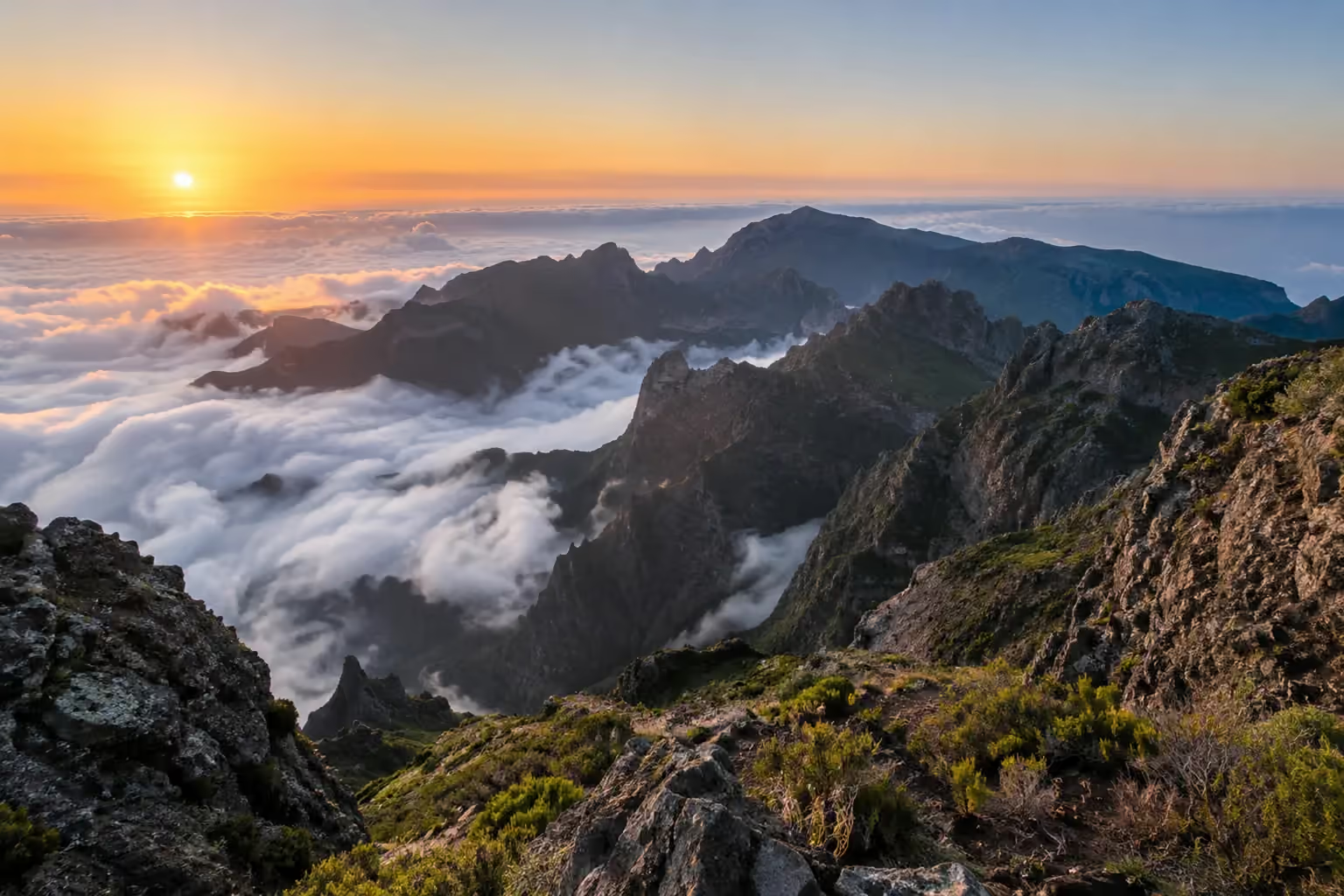
Central mountains: do not assume the whole route is open
Pico do Arieiro and the central mountains attract travelers seeking dramatic ridges, but the experience depends on the particular route and its current restrictions. A viewpoint visit is not the same activity as a mountain hike. Avoid booking a transfer under a broad ‘sunrise’ label without asking what walking is actually included.
Visit Madeira’s PR1 page checked on 8 October 2026 describes two options: the 1.2 km walk to Pedra Rija with a return by the same path, or the 6.1 km route to Pico Ruivo. Beyond Pedra Rija, the full route is one-way. A return bus at Areeiro therefore fits the short outing; the full walk needs onward walking and collection elsewhere. Recheck the current rules before travel.
Rabaçal and levada walks: choose the actual path
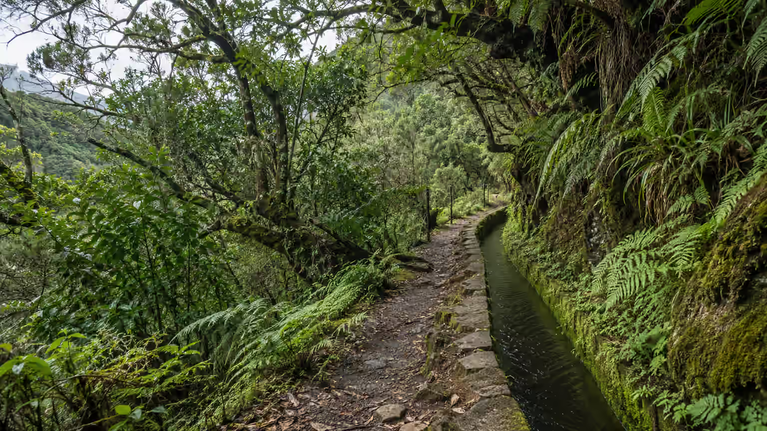
A levada is a water channel; the label does not mean that every accompanying path is easy, flat, or appropriate for every traveler. Narrow sections, slippery surfaces, steps, tunnels and exposure can matter more than a photograph of greenery. Check the individual route, including the return, against your group’s experience.
In the Rabaçal area, distinguish the chosen walk from the transport access. Ask where your vehicle will stop and how you reach the start from there. Do not combine several named trails simply because they share a general location: connecting sections, restrictions and your remaining daylight need separate consideration.
Ponta de São Lourenço: a different type of day
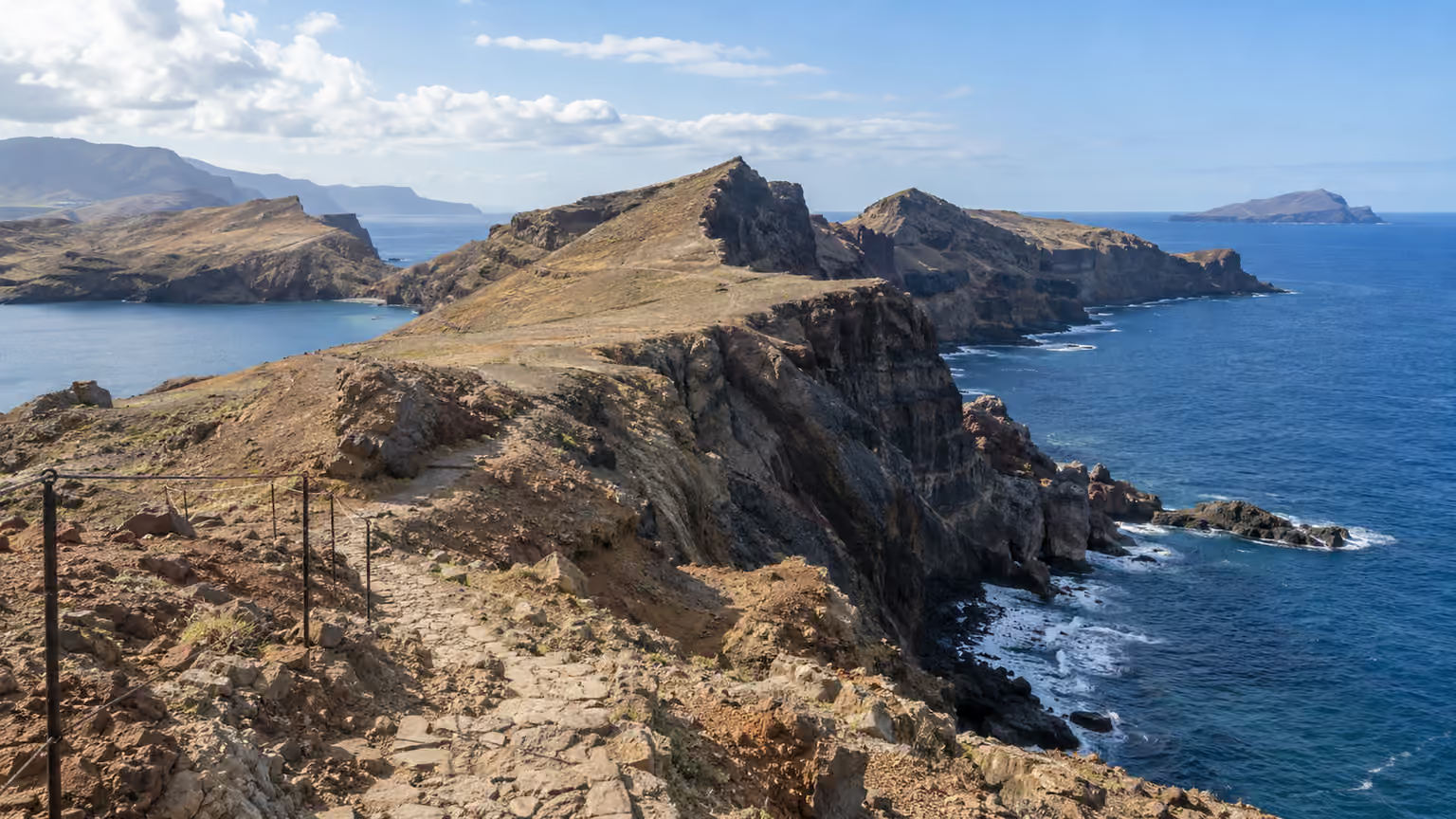
The eastern peninsula is a coastal walking area, so do not pack as though you are spending the day under forest cover. Check the official description and forecast before choosing it, and plan for sun, wind, and changing conditions. Carry what the walk requires rather than assuming you can obtain water along the way.
If you are not driving, confirm the actual stop and return service or arrange a specific transfer. Do not let a last departure time force the group to rush. A walk should include time to turn around, pause, or abandon the plan; a transport booking should accommodate those decisions safely.
Status, fees and reservations are separate checks
Visit Madeira states that classified PR walks require an advance reservation through SIMplifica. Its pages checked on 8 October 2026 list €4.50 for visitors over 12 on PR11 and the short PR1 outing, while full one-way PR1 is €10.50. These are dated examples, not a single price for every route. Select your actual route and entry slot in the official portal, then confirm the applicable fee and exemptions.
Check both permission to access the route and any reservation or payment requirement. A purchased tour does not automatically tell you whether those items are included. Ask the provider to state who makes the reservation and what happens if the route becomes unavailable. Save any confirmation needed for the day.
Build the return journey before setting off
Choose between a rental car, a dedicated transfer and a guided walk based on the exact route. A car is straightforward only when you can return to it appropriately. For a point-to-point walk, arrange the collection location and communication plan before departure rather than relying on an assumed taxi connection.
Start with the trailhead table above, then open the linked operator timetable. Match old and new route numbers, select a service that reaches the named stop, and check the operating day and connection to the official start. If the connection is uncertain, choose another walk or book transport. Reducing ambition is a better planning decision than disguising an unresolved return as an adventure.
Choose a base around your trail journeys · Compare hotel locations and facilities · Compare a rental car with transfers and other Madeira transport
- Check the route’s official status and accessible section shortly before departure.
- Check the forecast and any official alerts; follow closures and local instructions.
- Carry suitable footwear, water, layers, a charged phone, and navigation.
- Tell someone your plan and agree what happens if the group returns early.
- Never cross barriers or enter a closed section for a photograph.
Frequently asked questions
Can I download a GPX track from this map?
No. The map plots official access locations for planning; it does not contain a surveyed trail track. Open the official route page from the numbered key, use a suitable navigation resource and check current restrictions.
Are the walks shown open today?
The graphic does not display live status. Check IFCN’s current entry for the exact route and section before traveling to the trailhead.
Does a guided hike include the required reservation?
That depends on the product. Ask who handles the booking or fee and how a closure affects your reservation before paying.
Sources and editorial approach
This research-based planning guide is not a first-hand hotel, trail, or tour review. Area recommendations and itinerary choices are editorial judgments. Use the official references below for current visitor information. They do not verify a specific departure, property, or travel date.
Check before you go · Official access locations, PR1 and PR8 information, and the HF Areeiro timetable were checked on 8 October 2026. Prices and departure times are dated examples; recheck route restrictions, entry slots and transport for your date.
- Recommended walking routes (PR list)
IFCN: Instituto das Florestas e Conservação da Natureza · link recorded 2026-10-06
Official list of classified routes and their current status. Check on the day of your walk.
- FAQ: fees and reservations for classified routes
IFCN · link recorded 2026-10-05
Linked from IFCN’s route page, which describes a fee and reservation model from January 2026. The FAQ and booking transaction have not been independently verified here; confirm current requirements directly.
- Official classified-walk booking and payment portal
SIMplifica: Madeira government · link recorded 2026-10-06
Booking destination linked by IFCN. We have not tested checkout or availability; confirm the applicable route, date, and current requirements directly.
- Current bus routes and timetables
SIGA · link recorded 2026-10-06
Official route directory retrieved through DataForSEO. Open the applicable route and confirm the operating day and return journey; PDF departure times are not reproduced here.
Read our editorial policy.
Related guides
- BasesWhere to Stay in Madeira: Choose Your BaseWhere to stay in Madeira depends on your days, transport and trails. Compare Funchal, the southwest, the green north and the airport side.
- Hotel shortlistBest Hotels in Madeira: Luxury, Boutique & Coastal StaysBest hotels in Madeira depend on your trip. Compare six luxury, boutique, coastal and family stays, with location trade-offs and booking checks.
- Getting aroundDo You Need a Car in Madeira?Do you need a car in Madeira? Compare when renting helps, when driving becomes a burden and which no-car alternatives fit your trip.
- ItineraryMadeira Itinerary Without a Car: 7 DaysMadeira itinerary without a car: this 7-day plan uses Funchal as a base, walking, buses and booked tours, with shorter 3- and 5-day versions.